The Indian border with China is divided into three sectors; the eastern sectors comprise of the state of Arunachal Pradesh and Sikkim, the largest disputed area of 90,000 square kilometers. Arunachal Pradesh shares its borders with the states of Assam and Nagaland to the South, Bhutan in the West, Myanmar in the East and China in the North. In 1912, the British named it the North Eastern Frontier Agency (NEFA). The state is home to Christians, Hindus and Tibetan Buddhist. 63 percent of its population belongs to faiths other than Hinduism and contains one of the highest numbers of Buddhists in India.
It was in 1914 that the British Foreign Secretary, Sir McMahon, drew a 550 mile border between British India and Tibet which was signed by British and Tibetan representatives. China objected to the validity of the demarcated border since it was not a signatory to the agreement. China’s position was that Tibet was not independent from China and could not sign treaties and therefore, the accord was invalid. In a reply to Nehru’s memo of 1959, Chinese leader Zhou Enlai made it clear to Nehru that the British policy of aggression cannot be considered legal.
During the 1962 war in NEFA, the Indian army proved too weak to fight the Chinese army considering it came down to Tezpur in Assam. During the war, all of Arunachal Pradesh was occupied by the Chinese army which later withdrew voluntarily. According to Bruch Riedel, “India was humiliated and Nehru devastated. Indians had been driven from the East and even Calcutta was at risk. Nehru was so desperate that he requested the United States to rescue them.” The NEFA was renamed as Arunachal Pradesh and made a union territory in 1972. Later in 1987, it became an Indian state.
China’s Foreign Ministry spokesman, Zhao Lijian, made it clear last year that China has never reorganised Arunachal Pradesh as a state of India since it is in China’s South Tibet region. China claims its sovereignty over Arunachal Pradesh, which is under the illegal control of India. The Tawang region in Arunachal Pradesh is centre of the dispute. China also claims that the sixth Dalai Lama, Tsanyang Gyatso, was born in Tawang therefore Arunachal Pradesh is more so a part of Tibet.
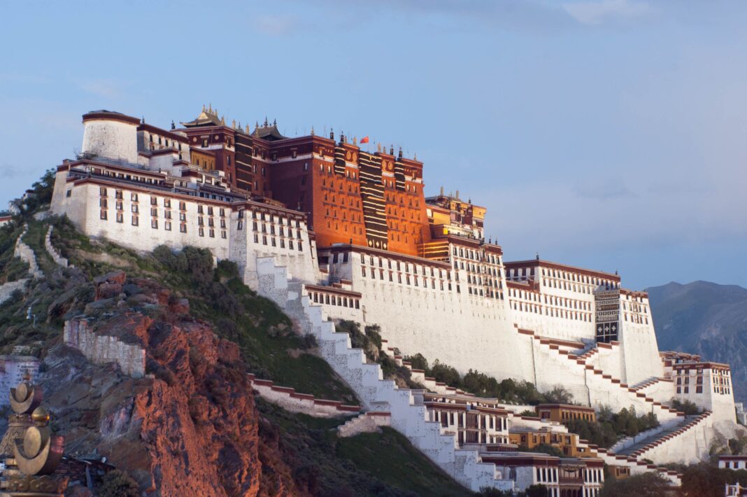
Tawang was part of Tibet but in 1914, it became part of Arunachal Pradesh after the British demarcation. Despite that, Tibet continues to administer the Tawang Monastery as India took control of it in 1951. The population of Tawang predominantly belongs to the Monpa tribe that speaks the language of Tibet and practices Tibetan Buddhism. The Tawang Monastery is the second largest Tibetan Buddhist monastery in the world, after Potala place in Lhasa. Tawang is also strategically important because during the 1962 war, the Chinese army came down through the Bumla Pass north of Tawang town. If China occupies it, it will facilitate their occupation of the Assam plains.
Arunachal Pradesh is strategically important to both India and China. Arunachal Pradesh provides security to Bhutan from its eastern flank. In the case that Tawang is occupied by China, Bhutan will be at the mercy of the Chinese pincer attack. The state of Arunachal Pradesh provides strategic depth to the Brahmaputra valley and North Eastern States. India will lose all its states in the North East to China or become independent. Therefore, it is vital for its defence in the North East.
China has been objecting to visits by Indian leaders to the disputed region. It objected to Dalai Lama’s visit to Tawang by stating that his visit violated India’s commitments on the border dispute. China also objected to PM Modi’s visit to the state in February 2015 to participate in the celebration marking 29 years of Arunachal Pradesh’s integration to India. China also condemned the visit of Home Minister, Amit Shah, to the region by saying that the visit violated Beijing’s territorial sovereignty. Even Lobsang Sangay’s visit to attend the oath taking ceremony of PM Modi was rejected.
In 2019, China destroyed 30,000 world maps in the country for not mentioning Arunachal Pradesh as part of its territory. During the summit of the Belt and Road Initiative (BRI) in Beijing, China removed a map from the website that depicted the entire IIOJK and Arunachal Pradesh region as part of India. China has given Chinese names to six places in Arunachal Pradesh to reaffirm its territorial sovereignty over the disputed state. According Mao, Tibet is the right hand’s palm of China and Ladakh, Nepal, Sikkim, Bhutan and NEFA are its fingers.
In January 2021 there was a fresh clash between the Chinese and Indian soldiers at the Naku La pass region in Northern Sikkim. Last year, India accused the Chinese People’s Liberation Army for kidnapping five villagers from Arunachal Pradesh. China dismissed these claims. Recently Indian has claimed to have discovered a newly constructed Chinese village inside their area of responsibility. China has rejected Indian claims and said, “This is beyond reproach as it is in our territory.” In its latest map issued in 2020, China has included Arunachal Pradesh within its boundaries. The Chinese claim that Arunachal Pradesh in its entirety is its territory and Tawang is only one of the places in it is clear. There is a chance of the situation getting out of control if tensions spread eastwards from the west. A tense face off is expected between the Chinese and Indian troops in the disputed region. Indians understand that it would be disastrous for them to lose Arunachal Pradesh to China as it would mean the entire North Eastern region of India will have been taken away.
China’s South Tibet


